
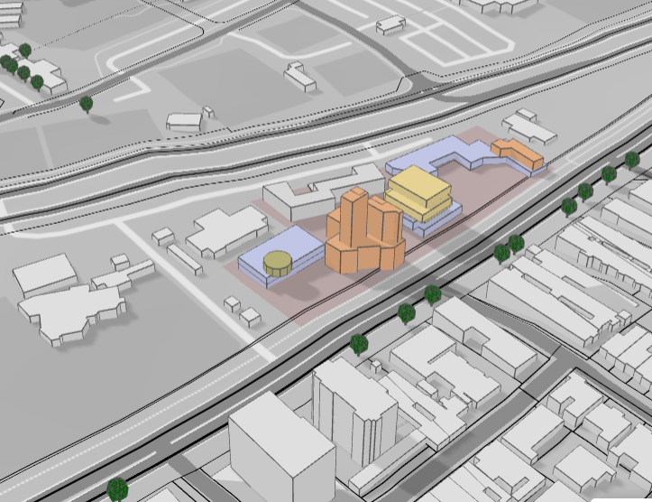
Integrating Autodesk Forma with ArcGIS allows urban planners, urban designers and architects to ground their conceptual designs in accurate, real-world geospatial data, enabling rigorous analysis of environmental, social, and physical factors from the very beginning of a project.
Forma Site Design by Autodesk is a cloud-based platform specifically designed for early-stage planning and analysis. It allows designers to explore design concepts, test performance, and collaborate with teams globally. The primary goal of Forma is to enable fluid and precise design processes where feasibility, terrain, and environmental constraints are evaluated from day one, rather than relying on limited or outdated information.
ArcGIS, developed by Esri, is widely considered the global standard for mapping and spatial analysis. It provides deep geospatial insights by offering detailed data on topography, land use, infrastructure networks, environmental features, and demographics. ArcGIS allows users to understand the broader context and “bigger picture” of a site before specific design work commences.
The integration is facilitated by the ArcGIS for Autodesk Forma extension, which bridges the gap between Building Information Modeling (BIM) and Geographic Information Systems (GIS). Instead of manually importing files or switching between platforms, this integration brings authoritative ArcGIS data directly into the Forma design workspace.

When these tools are used together:
- Real-Time Context: Users can select a site in Forma and automatically import detailed layers from ArcGIS, such as terrain, existing infrastructure, and environmental features.
- Data Richness: Teams can access specific datasets like flood risk maps, zoning boundaries, tree equity scores, and bike paths directly within their 3D massing model.
- Seamless Workflow: The integration anchors a project to its real-world location, and once the conceptual design is refined, the georeferenced model—preserving its terrain and infrastructure accuracy—can be exported to Revit for detailed development.
Performing Urban Analysis
Using these tools in tandem enables a “site-first” approach to urban analysis, where decisions are evidence-based rather than assumed.
1. Environmental and Climate Analysis Designers can import data regarding flood plains and hydrology to assess risk and plan necessary buffers or drainage strategies. Forma’s native analysis tools can then simulate microclimates, testing how a proposed massing interacts with sun, wind, and daylight. ArcGIS allows users to import additional environmental data.
- Wind & Ventilation: Analysis can identify “wind tunnels” created by building layouts or opportunities to capture prevailing breezes for natural ventilation,.
- Solar & Energy: Sun hour analysis helps optimize building orientation to avoid dark public spaces or determine the most effective placement for solar panels.
- Microclimate: By combining historical weather data with 3D models, teams can assess perceived temperatures across a site during different seasons, ensuring outdoor comfort.
2. Physical and Infrastructure Analysis The software allows users to visualize existing constraints, such as roads, utilities, and surrounding buildings.
- Noise Analysis: Planners can simulate how traffic noise from busy streets impacts communal areas, allowing them to arrange buildings to shield quiet zones.
- Connectivity: By importing layers for bike lanes and pedestrian paths, designers can align their projects with existing city infrastructure and future urban renewal plans,.
3. Regulatory and Socio-Economic Analysis Planners can overlay zoning data and land use regulations directly onto the site to ensure compliance with height or density requirements. Furthermore, socio-economic layers, such as demographic data can be visualized to ensure designs promote equitable outcomes and address community needs.
Using Autodesk Forma’s built-in geolocation and analysis environmental analysis functionality, designers can easily analyse design concepts. Overlaying spatial data from the ArcGIS data base will allow designers to make informed design decisions early on during the design phase. Using these two tools will allow urban planners, designers, and architects to create informed design decisions from the start, freeing up time for additional tasks.

